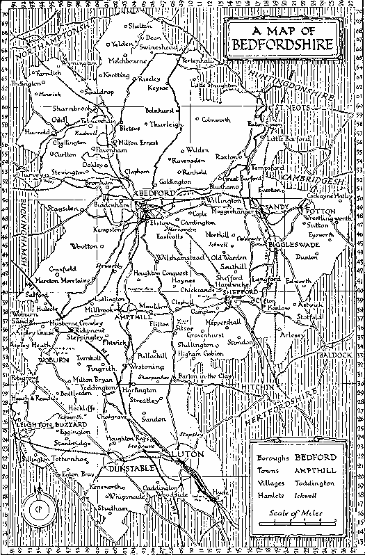
An Active Map of Bedfordshire
Last updated 26th November, 1996.
Ampthill
| Bedford | Cardington
| Cople | Cranfield | Dunstable
| Houghton
Conquest | Kempston
| Leighton Buzzard | Lidlington | Luton
| Millbrook | Oakley
| Pertenhall
| Steppingley
| Woburn

Note: Since this map was drawn, minor boundary changes in 1965 have added
Linslade and excluded Eaton Socon. Also, the railway lines between Hitchin and
Bedford and Sandy and Bedford have been closed and dismantled.
(Map borrowed from the "Pictorial Guide to Bedfordshire" by Eric Meadows, White
Crescent Press Ltd, Luton, Bedfordshire, UK, 1975. ISBN 0-900804-10-6)
Ampthill
| Bedford | Cardington
| Cople | Cranfield | Dunstable
| Houghton
Conquest | Kempston
| Leighton Buzzard | Lidlington | Luton
| Millbrook | Oakley
| Pertenhall
| Steppingley
| Woburn
